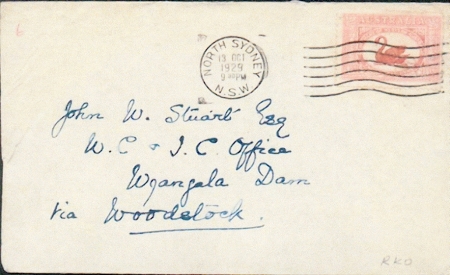
The cover is addressed to John W. Stuart Esq, Wyangala Dam, via Woodstock and the carmine-red 1½d ‘Centenary of Western Australia’ Swan stamp is postmarked with a roller cancel NORTH SYDNEY/ 13 OCT/ 1929/ 9 30 PM/ N.S.W. The reverse was not seen (Figure 1).
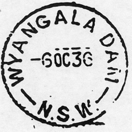
The Wyangala Dam post office opened on 14 March 1929 and the first postmark was of the Type 2C configuration, with a stop after the ‘W’ of ‘N.S.W.’ and closed in 1998 (Figure 2)
Wyangala Dam is situated on the Lachlan River, 48km upstream of Cowra, near the junction of the Lachlan and Abercrombie Rivers. It was named after Wyangala Station (Wyangala is a Widahuri Aboriginal word of unknown meaning), one of the properties flooded by the waters of the dam when construction was completed in 1935. The headwaters of the Lachlan River were discovered by Deputy Surveyor George William Evans in 1815, and named in honour of Governor Lachlan Macquarie of New South Wales. By 1817 Lieutenant John Oxley had explored the Lachlan from its junction with the Belubula River to the Great Cumbung Swamp.
Settlement of the Lachlan Valley began soon after it was found. The discovery of gold in the region in the 1860’s attracted many gold seekers, eager to make their fortunes, who eventually settled in the valley. By early 1900, development in the region was considerable, although it was restricted by variable and uncertain river flows. A dam was needed to regulate the river flow and in 1928, following the completion of Burrinjuck Dam on the Murrumbidgee River, work started on the original Wyangala Dam.
Wyangala Dam can hold more than 1.2 million mega litres. That’s more than twice the water in Sydney Harbour. At its highest point, the structure is as tall as a 25 storey building. However. Wyangala Dam wasn’t always so large. The original dam had a storage capacity of 374,860 mega litres, and a surface area when full of 2520 hectares. It was built for three main reasons: to supply water to people and stock over an area of half a million hectares; to irrigate 15,000 hectares along the upper reaches of the Lachlan River; and to open up a quarter of a million hectares west of Euabalong for settlement and development as wheat farms.
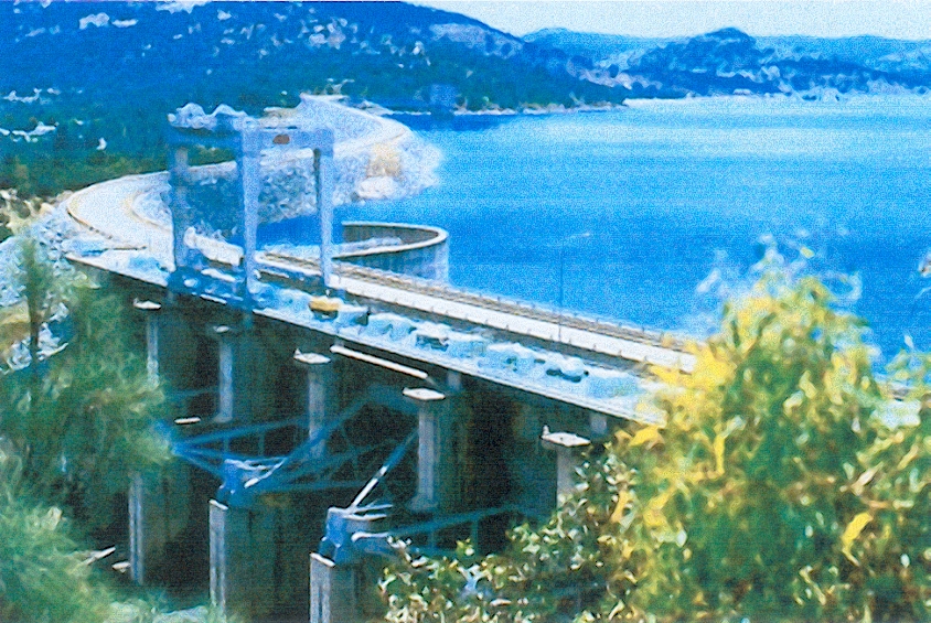
Today, the dam provides water for a far larger area. The major crops irrigated by water from Wyangala are wheat and cereals, and lucerne is the main crop irrigated in summer. Although designed and built to the highest standards at the time, the original dam had shortcomings by today’s standards. There were fears it could be subjected to unacceptably high stress by floods greater than those the spillway was designed for. Investigations showed that raising the crest level of the dam by 23.5 meters would increase the storage capacity by almost four times. This worked out to be cheaper than building alternative storage on a Lachlan River tributary, as the enlargement work was carried out at the same time as strengthening the original structure. Work began after a Parliamentary Act was passed in 1961. The enlarged Wyangala Dam is shown in Figure 3.
In 1971, the work was completed. The new embankment, built immediately downstream of the original wall, was made of rock fill with an earth-filled core. A new spillway capable of withstanding a very severe flood was constructed, and a road bridge was built over the spillway. Outlet works were included in the design, with one low level and one high level outlet.